Quarry House
Quarry House was originally built between the surveys of the 1951 and 1963 OS maps (see the Rudchester Maps page). A wayleave agreement for water and electricity supplies for the proposed Quarry House was signed on 27 April 1953. Kenneth William Rye was living there on 12th August 1960, as shown in the court papers reported in the London Gazette from 1960, but I have not been able to find out any details of the petition.
Tom James sold 2.42 acres of woodland to the north and the 3 acre field to the south of Quarry House to Peter Geoffrey and Flossie Lilian Hodgkinson of Quarry House on 4th April 1967 for £1,750, and two smaller areas to the south (0.34 and 0.32 acres) on 17th July 1967.
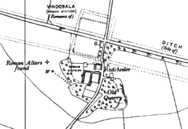
OS Map 1951
Click here for a high resolution photograph in a new window:
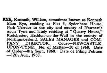
Court petition from 1960
Click here for a high resolution photograph in a new window:
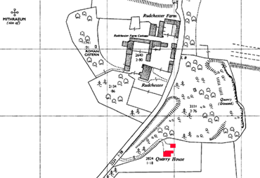
OS Map 1963
Click here for a high resolution photograph in a new window:
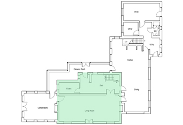
Quarry House was sold on 12th December 2000 for £300,000 (see Land Registry). Its floor plan was an "L" shape (shaded green below) on the 1967 OS map but it appears to have been extended in 2001, as an archaeological watching brief was undertaken during the construction of an extension by "The Archaeological Practice". The report is not available on-line, but no evidence of any features of archaeological significance were observed. There are no plans on the Northumberland County Council website. The original Shape is shown in green.
Quarry House was next sold in 2010 - the details do not appear on the HM Land Registry website. The owner applied for planning permission to demolish the existing house and build a 4-storey house with outbuildings in brick in 2014 designed by Napper architects. The application lapsed in 2018.
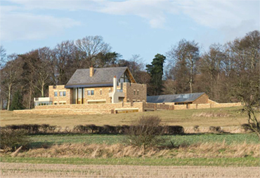
Quarry House 2020
Click here for a high resolution photograph in a new window:
.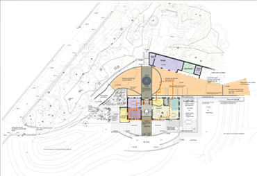
2014 plans
Click here for a high resolution photograph in a new window:
Render from 2014
Click here for a high resolution photograph in a new window:
Quarry House was sold to its current owners on 5th July 2021.