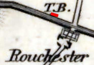
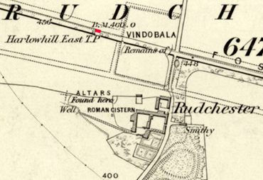
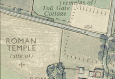
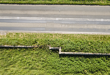
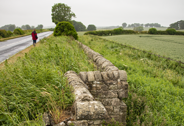
Toll Gate Cottage
"TB" (Toll Booth?) is shown in this location on maps from 1820 (Fryer, 1820; Greenwood 1828), "Harlowhill East TP" (Turnpike?) in the OS map from 1860, an unlabelled building in 1897 and 1898. It is not shown in the conveyance map of 1905, but is back (again unlabelled) in the 1919, 1921, 1947 and 1951 maps. In the 1963 and 1967 OS maps, it is labelled for the first time as "Toll Gate Cottage", but there is no sign of it now (other than the step in the dry stone wall shown below). See the Maps page
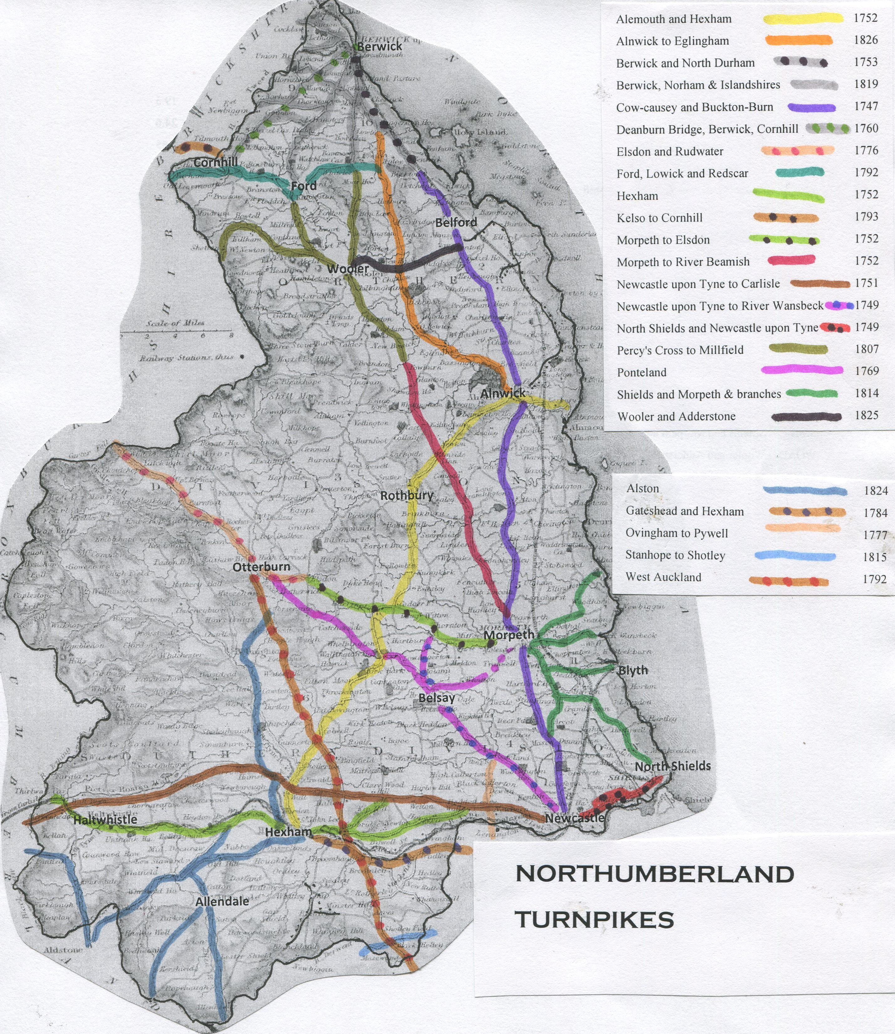
The Turnpike was established by the Carlisle and Newcastle Road Act, 1750 (Geo2 c.25 1750). It is shown as the Military Road Newcastle upon Tyne to Carlisle Turnpike in 1751 on the Northumberland Turnpikes map. 41 miles long with 4 main gates and 3 side gates. It generated £2000 in tolls in 1838 with the proceeds used to repair the road between the cities. See turnpikes.org.uk for more information.
1820
Click here for a high resolution photograph in a new window:
1860
Click here for a high resolution photograph in a new window:
1967
Click here for a high resolution photograph in a new window:
2021
Click here for a high resolution photograph in a new window:
2021
Click here for a high resolution photograph in a new window:
2021
Click here for a high resolution photograph in a new window: