1982 Rudchester Farm
Sale Particulars
This is typed document of 9 sheets with a map and 2 development illustrations dated 1982.
It describes Rudchester Farm of 202.5 acres for sale as a whole or in 3 lots:
Lot 1 - the Farmhouse, Farm Cottage and old steading with units, but interestingly, not the Dutch Barn and its leanto.
Lot 2 - 77.17 acres of mainly arable land with a ring fence (West of the Wylam road)
Lot 3 - 124.38 acres of mainly arable land (East of the Wylam road)
The details outline the situation, tenure (freehold), sporting rights (within Tynedale Hunt country and shooting rights included), minerals (included), water, timber, wayleaves, crops, ancient monuments (Vindovala fort, Hadrian's Wall and the Vallum), and its boundaries. There are descriptions of the Farmhouse and Cottage with their ratable values (£165 and £144 respectively).
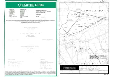
There is then a map of the area dated June 1982, which is based on the 1967 OS map, indicating the locations of the 3 lots.
The document states that "Discussions have been held with the planning authorities who have looked favourably on the proposal to convert these to nine residential units". The plan and artist's impression below, indicate the intention to knock down the East side of the North courtyard, the old garage and attached buildings along the road to open this up for parking, and construct 1 one-bedroom, 7 two-bedroom and one 3-bedroom - all of which would have been very small.
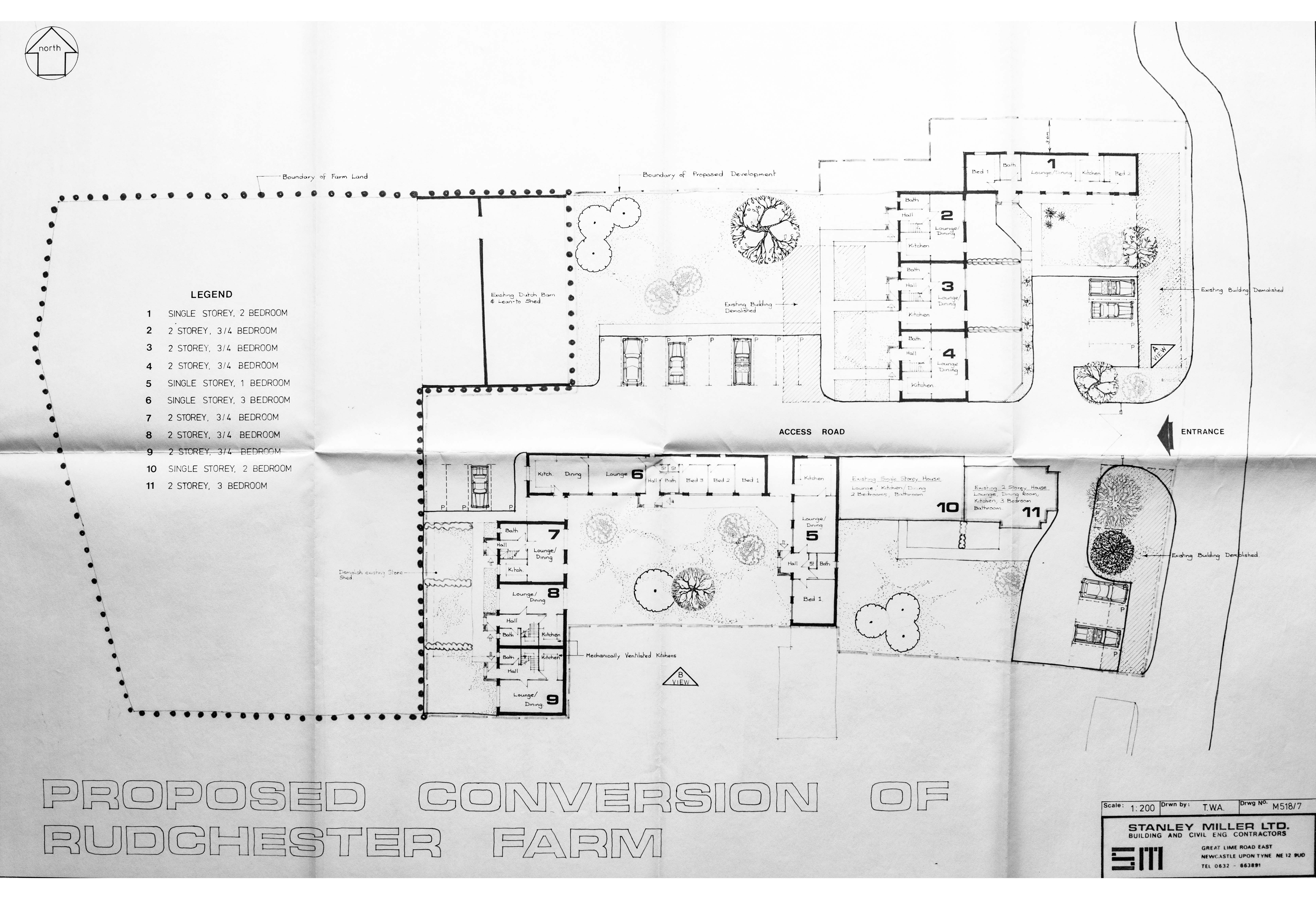
Development plan
Click here for a high resolution scan in a new window:
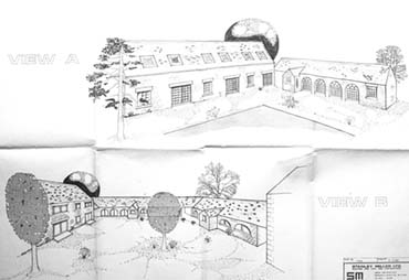
Artist's Impression
Click here for the full document in a new window:
Full Document
Click here for the full document in a new window: